
“Fill your life with adventures, not things. Have stories to tell not stuff to show.”
Unknown Author
Yesterday my son and I embarked on an adventure close to home. For years I have heard about the “radar base” in East Haven, VT. That is how it is know in these parts; simply the radar base. I decided to do a little research. It seems the radar base is actually an abandoned Air Force Base with radar towers on the summit of East Mountain. I discovered that my parents had actually visited this base via snowmobile many years ago. They described climbing through the dark towers onto the roofs and the amazing views. My mom’s friend’s husband was actually stationed at the base when it was in full operation. So now my curiosity was really piqued. I must know more about this place less than an hour from my home, with radar towers that can be seen from the waters of Maidstone Lake.
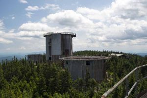
A standing memorial to the cold war, the radar base when commissioned in 1952 was to be called the East Haven Radar Station. However, when it opened in 1956 it was called the North Concord Air Force Station. It was originally slated to open in 1952 but due to funding opening was delayed. On March 1, 1956 the 911th Aircraft Control and Warning Squadron took up residence on the base and ground control radar on East Mountain became operational. Exactly six years after its opening on March 1, 1962 the Concord Air Force Station was renamed the Lyndonville Air Force Station. At that time new towers were built to house an updated radar system. The updated radar was never installed because in March of 1963 the Air Force ordered the site to close. Operations at the radar base ceased on August 1, 1963.
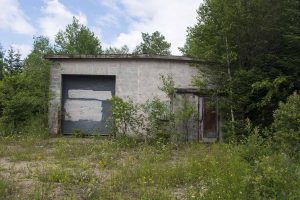
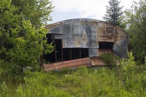
The radar base that once employed 174 military personnel must have been quite spectacular in its day. Tucked into the mountains of Vermont from 1956 to 1963 the base not only consisted of the usual mess hall, motor pool, and barracks. There was also a gymnasium, tennis courts, and bowling alley. The remnants of these can still be seen today.
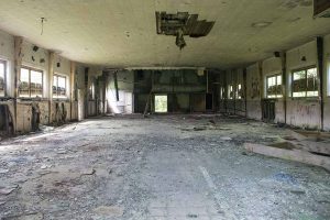
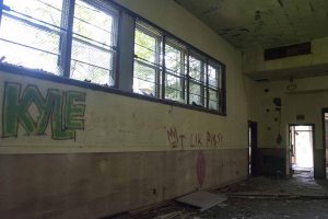
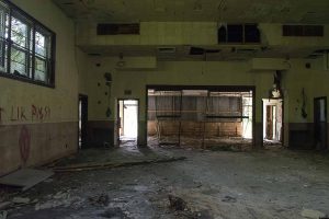
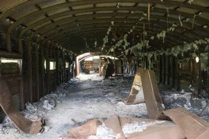
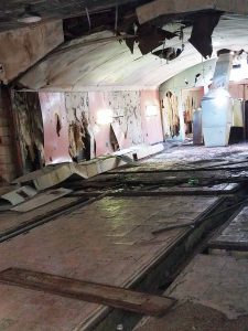
The radar base is also the site of strange happenings and tragedy. In 1961 it was the site of a UFO encounter. The sighting lasted 18 minutes. Three hours later in Woodstock, NH Barney and Betty Hill were allegedly abducted by aliens. There have been many books and articles written about this, and a movie based on it. In 1965 the land was sold to a private landowner who gated the property. One winter evening in 1969 the landowner noticed his gate was down so he regated the property. The landowner did not know that snowmobilers were still on the property. The snowmobilers not knowing that the trail had been gated behind them did not see the cable on their descent. One of the riders was decapitated. In the late eighty’s another death occurred when someone fell from one of the buildings. Today the base is little more than rubble. It is found on Vermont’s hazardous site list. The soil is contaminated and vandals have left the place littered and covered in graffiti. It seems dropping things from the towers to watch them smash has been a favorite pastime for some.
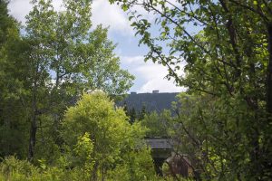
With a little knowledge of the history, I was more excited than ever to explore this base in the mountains of Vermont. From Route 102 in Guildhall I turned onto Granby Road. Granby Road eventually becomes Victory Road as you drive across the town line. From Victory Road I turned onto Radar Road and followed it to the end. I thought we were in for a 9 mile hike. From the information I had gathered I was expecting to have to park at the gate. I didn’t really notice “the gate” because I passed through so many along the way. They were all open with weeds and grass growing up around them, so I knew they had not been closed in a long time. I was surprised to suddenly find myself beside the motor pool. We parked next to the motor pool and began to explore the base area. I was surprised again when I noticed two other cars parked here. We were not the only people out for an adventure on this beautiful Saturday afternoon. In all we crossed paths with 12 other people exchanging information along the way.
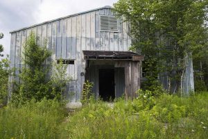
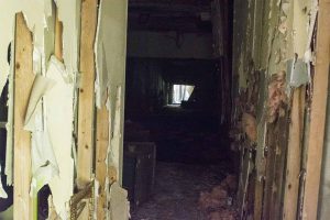
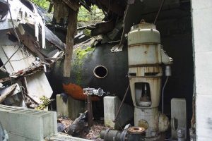
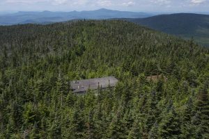
It is hard to explain my feelings as I wandered around the crumbling buildings. I tried to imagine what it must have looked like long ago. The now empty mess hall full of soldiers, mechanics working in the motor pool, people bowling and playing tennis in the rec area. It is quite sad to see all the graffiti and vandalism here. We wandered in and out of buildings exploring. Along with the mess hall, motor pool, gymnasium, tennis court and bowling alley, we found two building that must have been barracks, and a cement pad where a another building of some sort must have stood. After exploring the base we went back to the car for our packs and started our ascent to the summit where the radar towers sit. Along the way we found other building here and there. One was full of some kind of machinery.
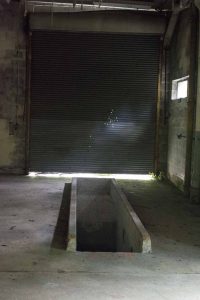
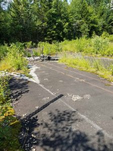
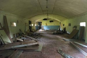
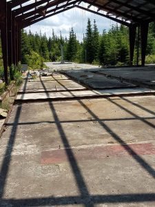
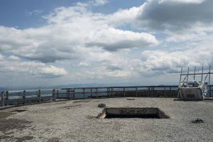
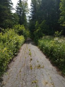
When looking up the road from the base it seems like you would be able to continue driving. My advise is to just park at the base. A short distance up the road it is blocked to motor vehicles. Some people who tried to drive up ended up parking along the road. Someone painted a message on the steel drum that blocks the road “1 hour 20 minutes up, 40 minutes down.” I was thankful for this message, because we were able to drive all the way to the base I really had no idea how far we had left to go. The road to the summit is just that, a paved road that has held up remarkably well considering its age. The climb to the top is moderately steep but very steady. Do not expect a flat spot to catch your breath. It is a 2.5 mile steady ascent. It took us 1 hour. We roamed around the summit for a while looking at the buildings. There was an interesting track system that seemed to go from tower to tower. Sort of a cement gully with a steel beam in the center. There is also a summit building with these same tracks in the floor. I am not sure what these were used for.
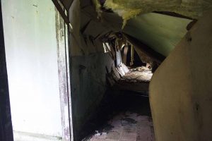
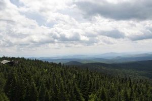
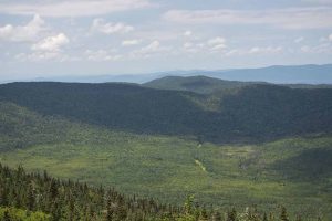
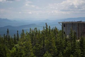
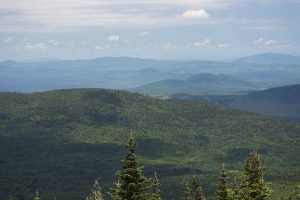
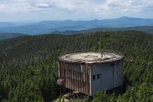
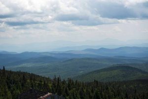
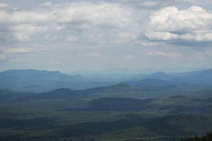
After exploring the ground at the summit we proceeded to climb the last small radar tower in the row of towers. The first few steps are missing some pieces. We worked our way across these and into the dark stairwell. I would advise using a flashlight here. We then came out into an open area. We took a doorway into a small room that was a little wet from some standing rainwater, then up a steel ladder and onto the roof. It is tight getting through the tubelike opening with a pack on. Here we enjoyed the view while we ate a picnic lunch. From the small tower we could just barely see Maidstone Lake. After finishing our lunch we decided to see if we could get into the tall tower. We walked around the building and finally found a door that had once been barred off. The lower bars have been removed and there is a hole that is wide enough to duck through. We climbed the long dark stairwell to an open area. Large holes in the walls let in plenty of light here. We again took a doorway into a small room. There is a broken stairway here, but a steel ladder climbs to the roof. I had removed my pack this time which made it easier to get through the tubelike opening. The views from the tall tower are amazing. Much of the east side of Maidstone Lake can be seen from here. It is very windy on top of the towers. If you are wearing a hat I suggest you remove it before stepping onto the roof. While walking around the roof of the towers we were careful not to step on the wooden areas. They looked quite rotted and not safe. The steel areas, though rusty in appearance seemed quite solid.
Our return to the base actually took us longer than the climb to the summit because we did a little geocaching along the way. There are several geocaches hidden here. My favorite being named “alien poop.” We logged 5 geocaches in all yesterday. It was a good day.
With a summit elevation of 3439 feet, East Mountain is the highest peak in Essex County. This has been one of my favorite places to explore. This is not a place for hiking with small children. Too much broken glass and dangerous rubble. This is, however, a great adult adventure. From the base the round trip distance is 5 miles. We located the gate on the way out 2 miles from the base. If that gate is closed hiking round trip distance would be 9 miles.
To see more pictures from this adventure and others please like my facebook page. There is a link to wildwoodphoto at the top of the page.
Recent Comments